Description:
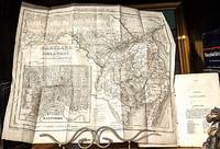
Texaco,, 1947.. Unbound. Used, very good. Very nice condition, slightest wear, small number "1" written on front cover otherwise clean and unmarked. ** We are a small family business selling fine new and pre-owned books online since 1999. We provide professional service and individual attention to your order, daily shipments, and sturdy packaging. FREE TRACKING ON ALL SHIPMENTS WITHIN USA.
Search Results: map of central america with the
You searched for:
- Omit specific booksellers from results: Bonita
- Title: map of central america with the
Results 1 - 19 of 19

Texaco Trip Map of the United States with Central Sectional (1947).
by Texaco.
- Used
- Condition
- Used, very good
- Quantity Available
- 1
- Seller
-
Kinnelon, New Jersey, United States
- Item Price
-
CA$34.54CA$5.18 shipping to USA
Show Details
Item Price
CA$34.54
CA$5.18
shipping to USA
Walker's Expedition to Nicargua: a History of the Central American War; and the Sonora and Kinney Expeditions, Including All the Recent Diplomatic Correspondence, Together With a New and Accurate Map of Central America, and a Memoir and Portrait of Genera
by William Vincent Wells
- New
- Condition
- New
- ISBN 10 / ISBN 13
- 9780461237009 / 0461237008
- Quantity Available
- 10
- Seller
-
Southport, Merseyside, United Kingdom
- Item Price
-
CA$33.72CA$17.47 shipping to USA
Show Details
Description:
New.
Item Price
CA$33.72
CA$17.47
shipping to USA

Stock Photo: Cover May Be Different
Walker's Expedition To Nicaragua - A History Of The Central American War; And The Sonora And Kinney Expeditions, Including All The Recent Diplomatic Correspondence, Together With A New And Accurate Map Of Central America
by William Vincent Wells
- New
- Paperback
- Condition
- New
- Binding
- Paperback
- ISBN 10 / ISBN 13
- 9781446082980 / 1446082989
- Quantity Available
- 10
- Seller
-
Southport, Merseyside, United Kingdom
- Item Price
-
CA$38.14CA$17.47 shipping to USA
Show Details
Description:
Paperback / softback. New.
Item Price
CA$38.14
CA$17.47
shipping to USA

Honduras; Descriptive, Historical, and Statistical, Etc. Being a Reprint of the Chapters on Honduras Contained in the Work Entitled, "The States of Central America." Edited by C. Gutie Rrez. with a Map
by Ephraim George Squier
- New
- Paperback
- Condition
- New
- Binding
- Paperback
- ISBN 10 / ISBN 13
- 9781249012467 / 1249012465
- Quantity Available
- 10
- Seller
-
Southport, Merseyside, United Kingdom
- Item Price
-
CA$43.50CA$17.47 shipping to USA
Show Details
Description:
Paperback / softback. New.
Item Price
CA$43.50
CA$17.47
shipping to USA

Stock Photo: Cover May Be Different
Walker's Expedition To Nicaragua: A History Of The Central American War ... With A New And Accurate Map Of Central America, And A Memoir And Portr. Of William Walker
by William V Wells
- New
- Paperback
- Condition
- New
- Binding
- Paperback
- ISBN 10 / ISBN 13
- 9781022406858 / 102240685x
- Quantity Available
- 10
- Seller
-
Southport, Merseyside, United Kingdom
- Item Price
-
CA$44.10CA$17.47 shipping to USA
Show Details
Description:
Paperback / softback. New.
Item Price
CA$44.10
CA$17.47
shipping to USA
Stock Photo: Cover May Be Different
Walker's Expedition To Nicaragua - A History Of The Central American War; And The Sonora And Kinney Expeditions, Including All The Recent Diplomatic Correspondence, Together With A New And Accurate Map Of Central America
by William Vincent Wells
- New
- Paperback
- Condition
- New
- Binding
- Paperback
- ISBN 10 / ISBN 13
- 9781446082980 / 1446082989
- Quantity Available
- 10
- Seller
-
Southport, Merseyside, United Kingdom
- Item Price
-
CA$45.99CA$17.47 shipping to USA
Show Details
Description:
Paperback / softback. New.
Item Price
CA$45.99
CA$17.47
shipping to USA

The Ancient Cities of the New World. Being Travels and Explorations in Mexico and Central America from 1857-1882. with Numerous Illustrations. Translated from the French and Abridged by J. Gonino and Helen S. Conant. with a Portrait and a Map
by Claude Joseph De Charnay
- New
- Paperback
- Condition
- New
- Binding
- Paperback
- ISBN 10 / ISBN 13
- 9781241444297 / 1241444293
- Quantity Available
- 10
- Seller
-
Southport, Merseyside, United Kingdom
- Item Price
-
CA$54.55CA$17.47 shipping to USA
Show Details
Description:
Paperback / softback. New.
Item Price
CA$54.55
CA$17.47
shipping to USA

Stock Photo: Cover May Be Different
Walker's Expedition To Nicaragua: A History Of The Central American War ... With A New And Accurate Map Of Central America, And A Memoir And Portr. Of William Walker
by William V Wells
- New
- Hardcover
- Condition
- New
- Binding
- Hardcover
- ISBN 10 / ISBN 13
- 9781020458385 / 1020458380
- Quantity Available
- 10
- Seller
-
Southport, Merseyside, United Kingdom
- Item Price
-
CA$59.80CA$17.47 shipping to USA
Show Details
Description:
Hardback. New.
Item Price
CA$59.80
CA$17.47
shipping to USA
Guide to the Maudslay Collection of Maya Sculptures, Cats and Originals from Central America. With 10 Plates, 20 Illustrations and a Map
by Collectif - British Museum
- Used
- Condition
- Used - Bon
- Quantity Available
- 1
- Seller
-
Broye, France
- Item Price
-
CA$37.48CA$44.98 shipping to USA
Show Details
Description:
Couverture rigide. Bon/1938. in-8. Oxford, Printed by Order of the trustees, 1938, in-8, 93pp, Cartonnage éditeur, Très bel exemplaire abondamment illustré
Item Price
CA$37.48
CA$44.98
shipping to USA

The West India Islands and Central America; with enlarged map of the Island of Jamaica - single original antique chromolithographed map from "The Comprehensive Atlas and Geography of the World
by W. G. Blackie
- Used
- Very Good
- Condition
- Used - Very Good
- Edition
- Original
- Quantity Available
- 1
- Seller
-
Wilmington, New York, United States
- Item Price
-
CA$103.61CA$6.89 shipping to USA
Show Details
Description:
London, Glasgow, Edinburgh and Dublin: Blackie & Son, 1886. Original. Map. Very Good. Very attractive double page map from "The Comprehensive Atlas and Geography of the World" by W. G. Blackie (1886). Paper size is approximately 14.75 inches by 22.25 inches (37.5 x 56.5 cm). Double page map, so has the original fold as issued. Blackie's atlas maps are very collectible, and the large folio size makes them well suited to display. Printed single sided and with nice margins, the maps from this book are very handsome, interesting, and perfect for framing. Flaws and notes: some edgewear overall; inset map of Jamaica. Otherwise intact and clean and ready for display. Please see the image. The sheet was too large to get a good quality picture, so it is a little washed out and fuzzy. Please request detailed close up scans, more pictures or information if needed.
Item Price
CA$103.61
CA$6.89
shipping to USA
More Photos
New Map of Maryland & Delaware with Their Canals, Roads & Distances; From: Geographical Historical and Statistical View of the Central or Middle United States
by H. S. Tanner (Tanner's Universal Atlas)
- Used
- Condition
- Used - Very good +
- Quantity Available
- 1
- Seller
-
Sisters, Oregon, United States
- Item Price
-
CA$310.84CA$6.22 shipping to USA
Show Details
Description:
Philadelphia - New York: Published by H.S. Tanner, 1841. Very good +. [Map Only] 14"x12-1/4" Outside Margins. includes pages 293,295 & 296 from the book. -- Condition of map.
Item Price
CA$310.84
CA$6.22
shipping to USA

More Photos
Map of Mexico, Central America, and the West Indies. (with four insets) 49. Map of the Island of Cuba. 50. Map of the Island of Jamaica. 51. Map of the Bermuda Islands. 52. Map of the Panama Railroad."
by Mitchell, Samuel Augustus Jr. [Constructed & Engraved by W. Williams, Philadelphia. Entered ... 1860 by S. Augustus Mitchell, Jr. ... Pennsylvania.]
- Used
- near fine
- Condition
- Used - Near Fine
- Edition
- Second state. [pg #48 in upper right corner]
- Quantity Available
- 1
- Seller
-
New York, New York, United States
- Item Price
-
CA$476.62CA$5.53 shipping to USA
Show Details
Description:
Philadelphia: S.A. Mitchell Jr., 1865. Second state. [pg #48 in upper right corner]. Steel Engraving, hand colored. Near Fine. Single leaf, with center fold. 34cm x 54cm measurements to outer edge of decorative border. Steel engraving with elaborate hand coloring. Professionally framed, with frame measurements of 54cm x 73cm, gilt frame, glazed with optically correct glass. A very handsome package; Mitchell's "Map of Mexico, Central America, and the West Indies." professionally framed. Map condition is near fine with brilliant color, and only superficial wear. Source: Mitchell's New General Atlas, Philadelphia: Published By S. Augustus Mitchell, Jr. No. 31 South Sixth Street. 1865.
Item Price
CA$476.62
CA$5.53
shipping to USA

More Photos
Vintage Maps of Cambodia, Ceylon and Maledives with India: "Presqu' Isle de L'Indedela le Golfe du Gange" AND Presqu' Isle de L'Inde de la le Golfe du Gange" [with Golf de Siam , Bankok etc.] / With an additional map mounted verso: "Amerique Meridionale" [showing Central America and South America from Isles de Caribes to the "Detroit de Magellan"].
by Cambodia - Fer, Nicholas de / [Nicolas de Fer]. (1646 - 1720)
- Used
- Condition
- Used
- Quantity Available
- 1
- Seller
-
Skibbereen, Ireland
- Item Price
-
CA$419.78CA$58.47 shipping to USA
Show Details
Description:
1700. [Paris], c. 1700. Original copper engraved maps. 16 cm wide x 13.2 cm high. Mounted on paper. Very good condition. From a wonderful collection of Maps from an old english library (South Shields) - with a tiny library stamp to the mounting paper (The stamp is NOT on the Map). Nicolas de Fer (164625 October 1720) was a French cartographer and geographer. De Fer was the youngest of three sons of Antoine de Fer, who was also a cartographer. When he was 12, he became the apprentice of Parisian engraver Louis Spirinx, and made his first map, of the Canal du Midi, at the age of 23. After the death of his father in June 1673, his mother Geneviève initially took over the map making company, which had begun to decline. She passed it and the atelier, called Quai de L'Horloge, on to Nicolas in 1687 because of her old age. De Fer was so successful at improving the firm that, in 1690, he became the official geographer to Louis, Dauphin of France. With support from the Spanish and French Royal Families,…
Read More Item Price
CA$419.78
CA$58.47
shipping to USA
![[Collection of Six Folding Maps]: The World on Mercator's Projection. [with] Map Exhibiting...](https://d3525k1ryd2155.cloudfront.net/h/382/399/712399382.0.m.jpg)
More Photos
[Collection of Six Folding Maps]: The World on Mercator's Projection. [with] Map Exhibiting the Navigable Rivers, the Completed & Proposed Rail-Roads of Great Britain & Ireland, with the Coal Fields, Light House &c. [with] Central & Southern Europe with the Mediterranean Sea. [with] British Possessions in North America, with Part of the United States, Compiled from Official Sources. [with] Central America and the West Indies... [and] Asia
by HALL, S. & WALKER, J.
- Used
- Hardcover
- Condition
- Used
- Binding
- Hardcover
- Quantity Available
- 1
- Seller
-
Lewes, East Sussex, United Kingdom
- Item Price
-
CA$702.48CA$47.42 shipping to USA
Show Details
Description:
London: Longman & Co., 1840-41.. Six folding maps of various sizes between 52 x 63 cm and 38 x 46 cm, all dissected and mounted on linen, the map of Asia with original outline colour, others uncoloured, matching patterned papers to the folded end sections and with handwritten title labels to one side, all folding down to a uniform size and housed in a contemporary plain green cloth slipcase. A very good set. The map of Asia by John Walker, the others by Hall. The former features regional inset maps: the World - Canton, Tasmania, the River Hooghly, Singapore, Cape of Good Hope; the British Isles - the River Thames, Dublin Bay, the Caledonian Canal; Europe - the River Schelde, Odessa, Valetta; North America - Montreal, Quebec, Newfoundland; Central America and West Indies: Port Royal & Kingston, Jamaica, Havana.
Item Price
CA$702.48
CA$47.42
shipping to USA
Walker's Expedition to Nicaragua; a History of the Central America War; and the Sonora and Kinney Expeditions, Including All the Recent Diplomatic Correspondence, Together with a New and Accurate Map of Central America, and a Memoir and Portrait of General William Walker.
by WELLS, William Vincent.
- Used
- Hardcover
- first
- Condition
- Used
- Edition
- FIRST EDITION
- Binding
- Hardcover
- Quantity Available
- 1
- Seller
-
New York, New York, United States
- Item Price
-
CA$994.68CA$13.82 shipping to USA
Show Details
Description:
New York, Stringer and Townsend, 1856.. FIRST EDITION. 12°, publisher's black cloth, blocked in blind, spine gilt (some wear). Wood-engraved seal of Nicaragua on title page. Some browning, scattered foxing; 2-cm. tear in margin of map, which is otherwise in fine condition. Overall in good to very good condition. Signatures in ink of J.T. Williams, dated 1858, on front pastedown, front free endpaper, and blank verso of frontispiece. Stamp of Kenneth Williams on blank verso of frontispiece. Frontispiece (wood-engraved portrait with added tint block), vi, [11]-316 pp., large folding hand-colored map. ***
FIRST EDITION of this "highly partisan defense of the filibusters' regime" (DAB) in Nicaragua under William Walker. Save for Walker's own The War in Nicaragua (1860), Walker's Expedition is the best contemporary account of Walker's life and expedition to Nicaragua in 1855-56. Wells' account carries events up through Walker's election as president of Nicaragua and formal recognition of his government…
Read More Item Price
CA$994.68
CA$13.82
shipping to USA
Mitchell's new national map exhibiting the United States : with the North American British provinces, Sandwich Islands, Mexico and Central America, together with Cuba and other West India Islands
by W Williams; S Augustus Mitchell
- Used
- Acceptable
- first
- Condition
- Used - Acceptable
- Edition
- First Edition
- Quantity Available
- 1
- Seller
-
Boonsboro, Maryland, United States
- Item Price
-
CA$2,504.66CA$6.89 shipping to USA
Show Details
Description:
Philadelphia : S. Augustus Mitchell, 1856. First Edition. Map. Acceptable. [Large Wall-Map] 170 x 175 cm. (63 x 64 inches.) Canvas mounted on round wooden dowels. Hand colored lithographic map, showing antebellum United States, Mexico, Central America, Southern Canada, and the Caribbean. Borders of American States, Canadian Provinces, Mexican States and national borders colored. Inset maps of: the World in Mercator and Globular views; a map of the Sandwich Islands, Hawaii. Additional vignettes of Columbus's ship discovering America, Landing of the Pilgrims in 1622, and the Flying Cloud clipper ship, the American steam ship crossing the Atlantic. Foliate border. Varnish slight;y toned, yellowed. Some fray to top left outer margin. Creases at center. Scale [ca. 1:2,500,000].; (W 125 - W 62/N 55 - N 06). Prime meridians: Greenwich and Washington (D.C.). Includes distant, census, and statistical tables and explanation of road symbols. "This edition has new topographical detail in New…
Read More Item Price
CA$2,504.66
CA$6.89
shipping to USA
MAP OF THE UNITED STATES OF AMERICA, THE BRITISH PROVINCES, MEXICO, THE WEST INDIES AND CENTRAL AMERICA, WITH PART OF NEW GRANADA AND VENEZUELA
by Colton, Geo. W.
- Used
- Hardcover
- Condition
- Used
- Binding
- Hardcover
- Quantity Available
- 1
- Seller
-
Chevy Chase, Maryland, United States
- Item Price
-
CA$4,144.50CA$11.05 shipping to USA
Show Details
Description:
New York: published by J.H. Colton and Co., No. 172 William St, 1858. Large folding map, 33.5 x 39.5 on a 35 x 42 in. sheet, hand-colored and archivally backed with Japanese paper, tipped into embossed leather covers, rebacked. Gilt title on front board; a list of maps, atlases, guides and books published by J.H. Colton on front pastedown, over which a previous owner has laid down his bookplate. Inset maps of the Atlantic Ocean showing the American and European ports, and routes of the Ocean Steamers; and the Isthmus of Panama showing the routes of travel between Chagres and Panama. The map was drawn by Geo. W. Colton, engraved by John M. Atwood, with border design and engraving by W.S. Barnard. The border is decorated with grape vines and 12 vignettes, including engravings of the Valley of the Connecticut, the Capitol of Washington City, Cathedral City of Mexico, and Willammette Falls Oregon at the corners. A dramatic cartouche of an American eagle, wings spread, standing on a shield, overlooks a…
Read More Item Price
CA$4,144.50
CA$11.05
shipping to USA

Kostenko, L.F. Central Asia and the introduction of Russian citizenship. With a map of Central Asia. In Russian (ask us if in doubt)/Kostenko, L.F. Srednyaya Aziya i vodvorenie na ney russkoy grazhdanstvennosti. S kartoy Sredney Azii.
- Used
- Condition
- Used
- Quantity Available
- 1
- Seller
-
Malden, Massachusetts, United States
- Item Price
-
CA$4,281.27CA$13.80 shipping to USA
Show Details
Description:
Short description: In Russian (ask us if in doubt).1871, 21,5x14 cm. We have thousands of titles and often several copies of each title may be available. Please feel free to contact us for a detailed description of the copies available. SKUalb02dfcc84756eb4b7
Item Price
CA$4,281.27
CA$13.80
shipping to USA

More Photos
Mitchell's new national map, exhibiting the United States, with the North American British Provinces, Sandwich Islands, Mexico, and Central America. Together with Cuba and the West India Islands
by Mitchell, S. Augustus
- Used
- Condition
- Used
- Quantity Available
- 1
- Seller
-
St. Paul, Minnesota, United States
- Item Price
-
CA$11,915.44CA$16.58 shipping to USA
Show Details
Description:
Philadelphia: S. Augustus Mitchell, 1859. Large hand-colored wall map on rods, approx. 64" square, with 4 engraved vignettes, 3 inset maps (2 of the world, and 1 of the Sandwich Islands), all within an elaborate floral border; some infill along the margins, slight loss in the population tables at the bottom, and several cracks in the paper, the whole neatly and professionally backed with linen; overall appearance is certainly very good or better, with the usual small defects. America as it was on the eve of the Civil War. Unusual features of this map include the Shoshone Territory (what is now mostly Idaho), Colona (now part of Colorado), the unusually large Nebraska, the horizontal Utah and New Mexico, and the unusually small Dakotas. Phillips, Maps of America, lists only the 1856 edition. OCLC records examples from 1856, 1857 (both on conjoined sheets), 1858, 1860 and 1861, but not this.
Item Price
CA$11,915.44
CA$16.58
shipping to USA

Didn’t find what you’re looking for?
Try adding this search to your want list. Millions of books are added to our site everyday and when we find one that matches your search, we’ll send you an email. Best of all, it’s free.
Add to Want List

Are you a frequent reader or book collector?
Join the Bibliophile's Club and save 10% on every purchase, every day — up to $20 savings per order!

Social Responsibility
Did you know that since 2004, Biblio has used its profits to build 16 public libraries in rural villages of South America?
