or


Your Cart Items
More Photos
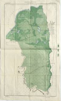
Underground Water Map - Utah - Salt Lake Sheet
Gardner, Frank D. & John Stewart
- Book Condition
- Used
- Seller
-
United States
- About Item
- Quantity
- 1
Item Price
CA$103.97
Standard shipping to USA: CA$4.16,
2 to 8 days for delivery
2 to 8 days for delivery

Join the Bibliophiles Club
Save 10% on this and every purchase — up to $20 savings per order! Membership is only $29.95/year.
Order Summary
Round Up for the Indigenous Literacy Foundation
The Indigenous Literacy Foundation (ILF) is an Australian not-for-profit founded in 2011 that works to address the educational disadvantages faced by Indigenous Australian children and young people by providing access to books and literacy programs.
