Description:
Philadelphia: H.C. Carey & I. Lea, 1822. Folio. (17 5/8 x 11 1/2 inches). Mounted on guards throughout. Letterpress title (copyright notice on verso), 1p. 'Advertisement' dated 'June 21, 1822' (verso blank), 1p. 'Contents' and 'Index' (verso blank). 46 double-page hand-coloured engraved maps of America, all but one with borders of letterpress descriptive text, 1 uncoloured double-page engraved view showing the comparative heights of mountains throughout the world, 1 hand-coloured double-page engraved table showing the comparative lengths of the principal rivers worldwide, 5 letterpress tables (4 double-page [3 of these hand-coloured]), 18pp. of uncoloured letterpress text. Expertly bound to style in half dark blue straight grained morocco over contemporary marbled paper covered boards, flat spine in six compartments divided by gilt roll tools, lettered in the second compartment, the others with a repeat decoration in gilt, marbled endpapers. First edition of one of the most important early atlases…
Read More Search Results: a complete historical chronological and geographical
You searched for:
- Title: a complete historical chronological and geographical
- Author: carey henry charles
Results 1 - 4 of 4

More Photos
A Complete Historical, Chronological, and Geographical American Atlas, being a guide to the history of North and South America, and the West Indies: exhibiting an accurate account of the discovery, settlement, and progress, of their various kingdoms, states, provinces, &c. Together with the wars, celebrated battles, and remarkable events, to the year 1822
by CAREY, Henry Charles, and Isaac LEA
- Used
- Condition
- Used
- Quantity Available
- 1
- Seller
-
New York, New York, United States
- Item Price
-
CA$11,070.40FREE shipping to USA
Show Details
Item Price
CA$11,070.40
FREE shipping to USA
More Photos
A Complete Historical, Chronological, and Geographical American Atlas, being a guide to the history of North and South America, and the West Indies: exhibiting an accurate account of the discovery, settlement, and progress, of their various kingdoms, states, provinces, &c. Together with the wars, celebrated battles, and remarkable events, to the year 1822
by CAREY, Henry Charles, and Isaac LEA (publishers)
- Used
- Condition
- Used
- Quantity Available
- 1
- Seller
-
New York, New York, United States
- Item Price
-
CA$15,221.80FREE shipping to USA
Show Details
Description:
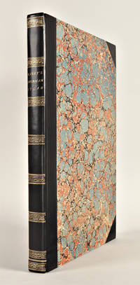
Philadelphia: H.C. Carey & I. Lea, 1823. Folio. (17 1/2 x 11 7/8 inches). Mounted on guards throughout, letterpress title (copyright notice on verso), 1p. Advertisement (verso blank), 1p. Contents (verso blank), 46 double-page hand-coloured engraved maps of the United States, all but one with borders of letterpress descriptive text, 1 uncoloured double-page engraved view showing the comparative heights of mountains throughout the world, 1 hand-coloured double-page engraved table showing the comparative lengths of the principal rivers worldwide, 5 letterpress tables (4 double-page [3 of these hand-coloured]), 18pp. of letterpress text. Expertly bound to style in half calf over contemporary marbled paper covered boards, flat spine in six compartments divided by gilt roll tools, red morocco label in the second compartment, the others with a repeat decoration in gilt. One of the most important early atlases printed in the United States: a handsome atlas of the Americas, with individual colour maps of…
Read More Item Price
CA$15,221.80
FREE shipping to USA

More Photos
A Complete Historical, Chronological, and Geographical American Atlas, being a guide to the history of North and South America, and the West Indies: exhibiting an accurate account of the discovery, settlement, and progress, of their various kingdoms, states, provinces, &c. Together with the wars, celebrated battles, and remarkable events, to the year 1822
by CAREY, Henry Charles, and Isaac LEA (publishers)
- Used
- Condition
- Used
- Quantity Available
- 1
- Seller
-
New York, New York, United States
- Item Price
-
CA$15,913.70FREE shipping to USA
Show Details
Description:
Philadelphia: H.C. Carey & I. Lea, 1823. Folio. (17 1/2 x 11 7/8 inches). Mounted on guards throughout, letterpress title (copyright notice on verso), 1p. advertisement (verso blank), 1p. contents (verso blank). 46 double-page hand-coloured engraved maps of the United States, all but one with borders of letterpress descriptive text, 1 uncoloured double-page engraved view showing the comparative heights of mountains throughout the world, 1 handoloured double-page engraved table showing the comparative lengths of the principal rivers worldwide, 5 letterpress tables (4 double-page [3 of these hand-coloured]), 18pp. of uncoloured letterpress text. Expertly bound to style in half dark green straight grained morocco over contemporary marbled paper covered boards One of the most important early atlases printed in the United States: a handsome atlas of the Americas, with individual colour maps of each state in the Union, including a seminal map of the West by Stephen H. Long. At the time of publication…
Read More Item Price
CA$15,913.70
FREE shipping to USA
More Photos
A COMPLETE HISTORICAL, CHRONOLOGICAL, AND GEOGRAPHICAL AMERICAN ATLAS, BEING A GUIDE TO THE HISTORY OF NORTH AND SOUTH AMERICA, AND THE WEST INDIES: EXHIBITING AN ACCURATE ACCOUNT OF THE DISCOVERY, SETTLEMENT, AND PROGRESS, OF THEIR VARIOUS KINGDOMS, STATES, PROVINCES, &c. TOGETHER WITH THE WARS, CELEBRATED BATTLES, AND REMARKABLE EVENTS, TO THE YEAR 1822
by Carey, Henry Charles, and Isaac Lea (publishers)
- Used
- Hardcover
- Condition
- Used
- Binding
- Hardcover
- Quantity Available
- 1
- Seller
-
New Haven, Connecticut, United States
- Item Price
-
CA$17,297.50CA$11.07 shipping to USA
Show Details
Description:
Philadelphia: H.C. Carey & I. Lea, 1823. Letterpress title (copyright notice on verso), 1p. advertisement (verso blank), 1p. table of contents (verso blank). Forty-six double-page handcolored engraved maps of the United States, all but one with borders of letterpress descriptive text; uncolored double-page engraved view showing the comparative heights of mountains throughout the world; handcolored double-page engraved table showing the comparative lengths of the principal rivers worldwide; five letterpress tables (four double-page [three of these handcolored]); 18pp. of letterpress text. Mounted on guards throughout. Modern half calf and marbled boards, spine gilt, leather label. Dampstaining along lower edge, causing chipping to initial leaves. Closed tear in bottom margin of first map, repaired with tissue. Very light offsetting from maps. Some dust soiling, light tanning and foxing. Good plus. A handsome atlas of the Americas, with individual color maps of each state in the Union, including a…
Read More Item Price
CA$17,297.50
CA$11.07
shipping to USA

Didn’t find what you’re looking for?
Try adding this search to your want list. Millions of books are added to our site everyday and when we find one that matches your search, we’ll send you an email. Best of all, it’s free.
Add to Want List

Are you a frequent reader or book collector?
Join the Bibliophile's Club and save 10% on every purchase, every day — up to $20 savings per order!

Social Responsibility
Did you know that since 2004, Biblio has used its profits to build 16 public libraries in rural villages of South America?
