Description:
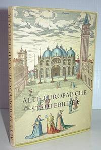
Bayreuth: Gondrom Verlag, 1976. Mit 32 Darstellungen auf 27 farbigen Blättern nach Georg Braun und Franz Hogenberg. Eingeleitet von Ruthardt Oehme. Großformatige Hardcoverausgabe, Querformat, 62 Seiten. Leeres Vorsatzblatt mit Widmung. Gutes Exemplar.
Salinae Saxonicae - Hall in Sachsen - Hildesheim by Braun, Georg & Hogenberg, Franz - 1572-1619
by Braun, Georg & Hogenberg, Franz

Salinae Saxonicae - Hall in Sachsen - Hildesheim
by Braun, Georg & Hogenberg, Franz
- Used
Cologne: G. Braun & F. Hogenberg, 1572-1619. Other. 363 by 519mm (14 by 20 inches).. Original copper engraving; hand colored in wash; published 1572-78 in volume V of the town book Civitates Orbis Terrarum by Braun and Hogenberg. The entire series of the Civitates Orbis Terrarum comprised six volumes and was published and printed from 1572 towards 1619. This decorative map is equipped with two city views. One shows the town Halle in Saxony and the other one the town Hildesheim in Northern Germany. The map is equipped with many houses, churches, trees, peoples, etc. Verso German text. Georg Braun (also Brunus, Bruin; 1541 10 March 1622) was a topo-geographer. From 1572 to 1617 he edited the Civitates orbis terrarum, which contains 546 prospects, bird's-eye views and maps of cities from all around the world. He was the principal editor of the work, he acquired the tables, hired the artists, and wrote the texts. He died as an octogenarian in 1622, as the only survivor of the original team to witness the publication of volume VI in 1617.
Braun was born and died in Cologne. His principal profession was as a Catholic cleric. However, he spent thirty-seven years as canon and dean at the church, St. Maria ad Gradus, in Cologne. His six-volume work was inspired by Sebastian Münster's Cosmographia. In form and layout it resembles the 1570 Theatrum orbis terrarum by Abraham Ortelius, as Ortelius was interested in a complementary companion for the Theatrum.
The Braun publication set new standards in cartography for over 100 years. Frans Hogenberg (15351590, from Mechelen) created the tables for volumes I through IV, and Simon van den Neuwel created those for volumes V and VI. Other contributors were Joris Hoefnagel, Jacob Hoefnagel, cartographer Daniel Freese, and Heinrich Rantzau. Works by Jacob van Deventer, Sebastian Münster, and Johannes Stumpf were also used. Primarily European cities are depicted in the publication; however, Cairo Casablanca and Mexico City as well as Cuzco on one sheet are also included in volume I, whereas Tunis is featured in volume II.
Frans Hogenberg (15351590) was a Flemish and German painter, engraver, and mapmaker.
Hogenberg was born in Mechelen in Flanders as the son of Nicolaas Hogenberg. In 1568 he was banned from Antwerp by the Duke of Alva and travelled to London, where he stayed a few years before emigrating to Cologne. He is known for portraits and topographical views as well as historical allegories. He also produced scenes of contemporary historical events.
Hogenberg died in Cologne.
(Wikipedia)
V / 48 In very good to excellent condition. 363 by 519mm (14 by 20 inches).
-
Bookseller
Antiquariat Reinhold Berg ek
 (DE)
(DE)
- Format/Binding Other
- Book Condition Used
- Quantity Available 1
- Publisher G. Braun & F. Hogenberg
- Place of Publication Cologne
- Date Published 1572-1619
- Keywords Antique map Map:Europe:Germany Halle / Saxonia - Hildesheim Braun, Georg & Hogenberg, Franz Salinae Saxonicae - Hall in Sachsen - Hildesheim Cologne G. Braun & F. Hogenberg 1572-1619
- Product_type map
- Size 363 by 519mm (14 by 20 inches).

Alte Europäische Städtebilder. 32 Darstellungen auf 27 farbigen Blättern nach Georg Braun und Franz Hogenberg
by Braun, Georg und Franz Hogenberg - eingeleitet von Ruthardt Oehme
- Used
- Hardcover
- Condition
- Used
- Binding
- Hardcover
- Quantity Available
- 1
- Seller
-
Neuendorf, Germany
- Item Price
-
CA$9.00
Show Details
Item Price
CA$9.00
More Photos
Alte Europaische Stadte-Bilder
by Braun, Georg; Franz Hogenberg, and Ruthardt Oehme
- Used
- very good
- Hardcover
- Condition
- Used - Very Good
- Jacket Condition
- Very Good
- Binding
- Hardcover
- Quantity Available
- 1
- Seller
-
Elizabethtown, New York, United States
- Item Price
-
CA$13.80
Show Details
Description:
Stuttgart: Tauchnitz, (1954.) Descriptions and maps of old European cities. From the Civitates Orbis Terrarum, the landmark atlas published between 1572 and 1617, with Georg Braun providing the text and Frans Hogenberg the engravings. Brief city descriptions and 24 double-page, color illustrations from the original atlas, depicting city views and plans, architectural and topographic features. All text is in German. 24+ [96] pages. 8vo hardcover. VG in VG jacket in clear archival cover. Gift inscription in German from 1955, light tanning to endpapers, but clean and unmarked otherwise. Sound, tight binding.
Item Price
CA$13.80

GAMLE EUROPAEISKE BYBILLEDER (24 farvelagte prospekter)
by Georg Braun og Franz Hogenberg
- Used
- Condition
- Used - Very Good
- Quantity Available
- 1
- Seller
-
Frederick, Maryland, United States
- Item Price
-
CA$17.27
Show Details
Description:
Boghallen. Used - Very Good. Very Good condition. Good dust jacket. Danish edition. (old illustrations european cities)
Item Price
CA$17.27
Alte europäische Städtebilder
by Georg Braun, Franz Hogenberg, Ruthardt Oehme
- Used
- Hardcover
- Condition
- Used - gebraucht, gut ExLibris,Schnittkante nachgedunkelt
- Binding
- Hardcover
- Quantity Available
- 1
- Seller
-
Oldenbüttel, Germany
- Item Price
-
CA$4.65
Show Details
Description:
Bertelsmann Lesering, 1965. hardcover. gebraucht, gut ExLibris,Schnittkante nachgedunkelt.
Item Price
CA$4.65
ALTE EUROPAISCHE STADTE-BILDER 24 Farbige Blatter
by Oehme, Rughardt, Georg Braun and Franz Hogenberg
- Used
- Hardcover
- Condition
- Used - Very Good in Very Good dustjacket
- Binding
- Hardcover
- Quantity Available
- 1
- Seller
-
Elwood, Indiana, United States
- Item Price
-
CA$21.99
Show Details
Description:
Farbiges Tauchnitz-Buch. Very Good in Very Good dustjacket. 1954. Hardcover. Illustrated in color. ; Small 8vo 7½" - 8" .
Item Price
CA$21.99
Alte deutsche Städtebilder
by Georg Braun and Franz Hogenberg
- Used
- Condition
- Used - Acceptable
- Quantity Available
- 1
- Seller
-
Frederick, Maryland, United States
- Item Price
-
CA$25.26
Show Details
Description:
Johannes Asmus Verlag. Used - Acceptable. Acceptable condition. No Dust Jacket German. 'Old German Cityscapes'. Reading copy only. Lacking backstrip. Short gifter's inscription on front pastedown. (history, germany, maps)
Item Price
CA$25.26
GAMLE EUROPAEISKE BYBILLEDER (24 farvelagte prospekter)
by Georg Braun og Franz Hogenberg
- Used
- Condition
- Used - Acceptable
- Quantity Available
- 1
- Seller
-
Frederick, Maryland, United States
- Item Price
-
CA$40.43
Show Details
Description:
Boghallen. Used - Acceptable. Acceptable condition. Acceptable dust jacket. Danish edition. (medieval, europe, cities, towns, pictorial works) A readable, intact copy that may have noticeable tears and wear to the spine. All pages of text are present, but they may include extensive notes and highlighting or be heavily stained. Includes reading copy only books.
Item Price
CA$40.43
Old European Cities
by Ruthardt Oehme, Georg Braun, Franz Hogenberg
- Used
- good
- Hardcover
- Condition
- Used - Good
- Jacket Condition
- Fairly Good
- Edition
- Revised Edition
- Binding
- Hardcover
- Quantity Available
- 1
- Seller
-
Reading, Berkshire, United Kingdom
- Item Price
-
CA$34.94
Show Details
Description:
London: Thames & Hudson, 1965. Orange cloth, 128 pages. Some marks on binding; dustwrapper frayed a bit, tear on back. 32 coloured 16th century city maps & texts from the Civitates Orbis Terrarum, with description of early map-making techniques. . Revised Edition. Hard Cover. Good/Fairly Good.
Item Price
CA$34.94

More Photos
Old European Cities; Twenty-four 16th-Century City Maps and Texts ...
by Braun, Georg; Franz Hogenberg; Arthur Hibbert; Ruthardt Oehme
- Used
- Hardcover
- Condition
- Used
- Binding
- Hardcover
- Quantity Available
- 1
- Seller
-
Doylestown, Pennsylvania, United States
- Item Price
-
CA$48.31
Show Details
Description:
London Thames & Hudson hardcover. From the Civitates Orbis Terrarum of Georg Braun and Franz Hogenberg, with an interpretation by Arthur Hibbert, and a description by Ruthardt Oehme of early map-making techniques. -- Hardcover. Condition: near fine (endsheets lightly tanned) with bright, near fine dust jacket (flaps clipped; couple short tears; edges lightly rubbed).
Item Price
CA$48.31
Deutschland vor drei Jahrhunderten. Seine Städte, Flüsse und Wälder.
by BLAEU, WILHELM UND JOAN / GEORG BRAUN, FRANZ HOGENBERG UND JORIS HOEFNAGEL
- Used
- Condition
- Used
- ISBN 10 / ISBN 13
- 9783570098516 / 3570098516
- Quantity Available
- 1
- Seller
-
Worpswede, Germany
- Item Price
-
CA$26.99
Show Details
Description:
Gütersloh.: Prisma Verlag., 1987.. Orig.Pappe.. 4°. Mit einem Nachwort von C. Broekema. Faksimile. Gut erhalten ISBN 3570098516.
Item Price
CA$26.99
