Boundary Between Alberta and British Columbia. 14 Two Colour Maps by Topographical Survey Of Canada - 1923
by Topographical Survey Of Canada
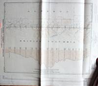
Boundary Between Alberta and British Columbia. 14 Two Colour Maps
by Topographical Survey Of Canada
- Used
- very good
- Paperback
Ottawa: Interprovincial Boundary Commission, 1923 Sheets 41 through 54 from Latitude 54/22/18 to 57/26/40. Each map meaures 14" by 19" and is in a scale of 1/62, 500 miles and is folded twice horizontally. The show camera stations, monuments, roads, and trails. All Very Good or better.
-
Bookseller
Ken Jackson
 (CA)
(CA)
- Format/Binding Soft cover
- Book Condition Used - Very Good
- Binding Paperback
- Publisher Interprovincial Boundary Commission
- Place of Publication Ottawa
- Date Published 1923
- Keywords CARTOGRAPHY AND MAPS|MAP BRITISH COLUMBIA ALBERTA BOUNDARY
